


Best ETABS Training in Kerala
Master ETABS for Structural Analysis Looking to build a successful career in Structural Engineering? Join the best ETABS course in Kerala offered by Skillz by Civilianz and gain practical expertise in structural analysis and design using ETABS. This industry-oriented training program on ETABS is specially designed to help civil engineering students and professionals master real-world […]

Best BIM Course in Kerala
Skillz by Civilianz provides best industry-Oriented BIM Course for Civil Engineers and Construction Professionals Master Building Information Modeling with Skillz The construction and infrastructure industry is rapidly shifting from traditional 2D drafting to intelligent 3D digital modeling. BIM (Building Information Modeling) has become the global standard for planning, designing, executing, and managing modern infrastructure projects. […]
TS & DGPS PROFESSIONAL
Syllabus Total Station GPS & DGPS Google Earth
DIGITAL LAND SURVEY PROFESSIONAL
Syllabus Total Station GPS & DGPS Google Earth GIS(Geographical Information System)

DIPLOMA IN L.S & DOCUMENTATION
Syllabus Total Station Digital Level GPS & DGPS Google Earth GIS(Geographical Information System) LiDAR

GIS
A geographic information system consists of integrated computer hardware and software that store, manage, analyze, edit, output, and visualize geographic data. Much of this often happens within a spatial database, however, this is not essential to meet the definition of a GIS. The innovative GIS technologies are useful to virtually any industry. Module 1: Introduction […]
LiDAR
Drone mapping is a remote sensing technology for creating 2D and 3D maps of an area using data from sensors mounted on a drone or an unmanned aerial vehicle (UAV).Drone mapping is an overlooked resource for drone professionals, as it allows for efficient coverage of large areas. This has led to increased encouragement from government […]
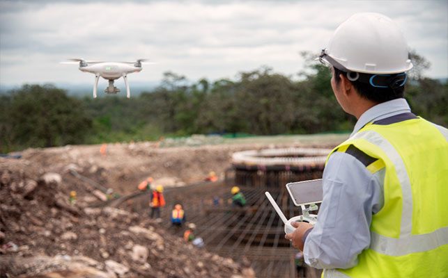
DRONE MAPPING
Drone mapping is a remote sensing technology for creating 2D and 3D maps of an area using data from sensors mounted on a drone or an unmanned aerial vehicle (UAV).Drone mapping is an overlooked resource for drone professionals, as it allows for efficient coverage of large areas. This has led to increased encouragement from government […]
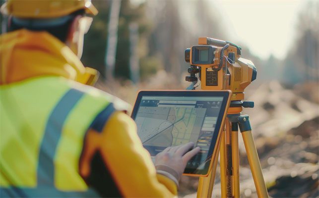
GPS&DGPS
This session that will be extremely beneficial for students interested in modern satellite surveys. The session will focus on the GNSS Survey, which is a time-saving and efficient tool for all geospatial operations. GPS is an essential component of advanced technology in the geospatial industry. By attending this session, students will take a significant step […]

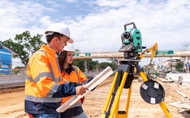
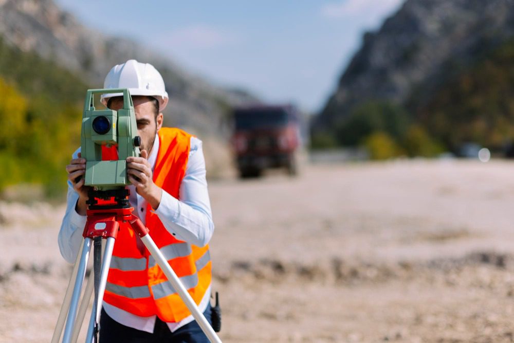
TOTAL STATION
Total station is a cutting-edge digital equipment that has revolutionized the way we approach geospatial applications. Its advanced features make it an indispensable tool in mining, cedestral, topography, and building construction. This module is designed to provide students with comprehensive knowledge about modern survey techniques, to help them stay ahead of the curve in this […]
- 1
- 2